Heading to Cumbria and not enjoying a walk or two would be a great shame. But with so many routes and hikes to consider, where is the best place to start?
Here we’ve pulled together a choice of 10 of the best Lake District walks which you should consider when you book a stay in one of our Lakeland cottages.
Loweswater Walk
Corpse Road has a morbid fascination about it. But the walk through Loweswater is not as eerie as it may first seem as you pass the breathtaking lake itself. There is plenty of lush woodlands in the area, where you may even spot a rare red squirrel and the route begins at Maggie’s Bridge Car Park, taking you nearly four miles through the foliage.
A map of the route can be found, here.
Coniston: Tom Gill to Tarn Hows
This short 1.6 mile walk is a great experience for the whole family and requires hiking to the top of a fell – but it’s certainly worth the walk. An idyllic top gives you the chance to take in one of the most idyllic views out over the Lake District and the tarn here is man made. Having been in situ since 1865 and given to the National Trust by Beatrix Potter. A path around the tarn has been made accessible for prams, mobility scooters and walkers of all ages and there is also a steeper incline route beyond Tom Gill Beck for more advanced climbers.
A map of the route can be found, here.
Windermere: Ash Landing to Claife Heights
A long walk which will require a few hours of your time is the 7.5-mile stroll from Ash Landing car park up and over Claife Heights. Majestic views can be experienced from the Heights on the western shore of the lake and the unique viewing station allows for a multi-coloured view of the landscape each and every season. While the ingenious design even allows for a moonlit view of the area.
A map of the route can be found, here.
Langdale From Elterwater to Mickleden
Langdale is one of the busiest spots in the Lake District, but on this 10-mile walk there will be plenty of opportunities to enjoy some much-needed peace and quiet. Beginning at Elterwater village, head out across the beautiful rural landscape and ascend up to 2837 foot at the highest peak. While exploring many of the best pikes in the region and out across barren stony landscapes and greenery. The route brings you back to Elterwater at the end, where you can enjoy a drink or bite to eat at the local pub.
A map of the route can be found, here.
Ambleside to Troutbeck
Heading out from Ambleside to Troutbeck along this National Trust route is a wonderful way of experiencing the exceptional sights of the Cumbrian countryside. Where you can spot the tallest grand fir in the whole of England, standing 57.8 metres tall and sitting in Skelghyll Woods. The walk itself is nearly six miles long, but you have plenty of chances to take in the local sites and scenery, including quirky villages, small picturesque towns and hidden gems like Stagshaw Gardens.
A map of the route can be found, here.
Derwentwater, Octavia Hill Walk
This dog-friendly Lake District ramble is a gentle ascent as you amble at your leisure along the quietest side of Derwentwater. As you travel along the trail you’ll discover Hawes End Jetty and head through Brandelhow. Return to Haws End Jetty after a 3.6 mile circular walk with plenty of opportunities to enjoy the scenery or stop for a picnic and give your furry friend and feet a rest.
A map of the route can be found, here.
Patterdale, Red Screes Walk
A walk with a view! The Red Screes Walk leads to an ascent of 2460 foot on its 7.5-miles path. Look north-west and you will spot Middle Dodd, Hartsop and the rolling Patterdale hills that make for a rigorous ramble. There are plenty of well-trodden routes through these mountains, but choosing to head onto Red Screes via Scandale Valley will reward with spectacular views of the surrounding scenery and a chance to take to a less popular and more tranquil route.
A map of the route can be found, here.
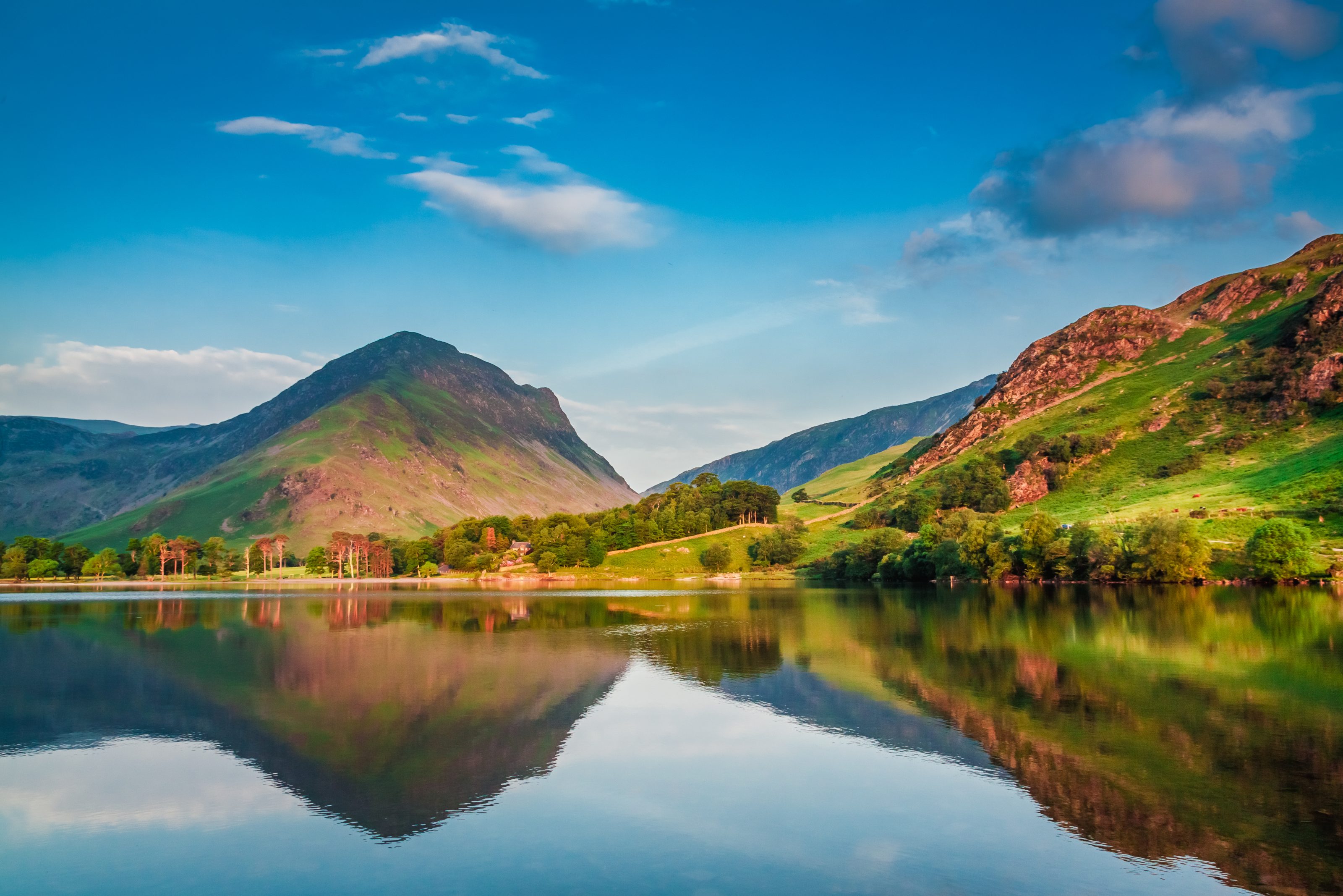
Buttermere to Rannerdale
Start your route at the National Trust car park in Buttermere and enjoy a gentle 3 mile ramble with spectacular views. At one end you will spot the well-known Sentinels, a collection of trees believed to be the most photographed in the country. While at the other you will pass by Crummock Water and the pretty pebble dashed beach. This is a route packed with picnic spots and the chance to take a plunge in the waters during the warmer months.
A map of the route can be found, here.
Stickle Tarn Trail
Beginning at Stickle Ghyll car park, this is a short but challenging trail that takes you up the valley side and out towards Longmoor. It is a difficult and steep incline, but there are many opportunities to stop along the way and take in the exceptional beauty of the waterfalls, rock formations and views out across the striking valley. As you travel upwards you can look back on your route and will come across many picture-perfect photo opportunities, so you can catch nature at its best.
A map of the route can be found, here.
Mickleden Valley Trail
Spend 2 hours absorbing the sights and sounds of Mickleden Valley on this gentle ramble. It is a chance to discover the hidden gem that is Mickleden – and in just 3.8 miles – and is a trail that you can take to in almost any weather. Begin at Old Dungeon Ghyll on a trail that is free from inhabitants of the human kind for miles around – once you pass Stool End Farm. This is a truly wild and natural walk with glacial moraines to look out for, as well as a chance to explore two ancient mountain passes once you reach the end of the route.
A map of the route can be found, here.
Recent Comments